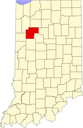
White County (Indiana)
| County in de Verenigde Staten | |||
|---|---|---|---|
| |||
| Situering | |||
| Staat | Indiana | ||
| Coördinaten | 40°45'0"NB, 86°51'36"WL | ||
| Algemeen | |||
| Oppervlakte | 1.318 km² | ||
| - land | 1.309 km² | ||
| - water | 9 km² | ||
| Inwoners (2000) |
25.267 (19 inw./km²) | ||
| Overig | |||
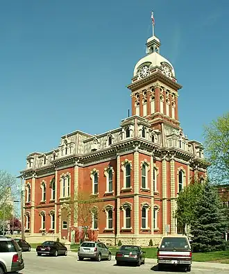
| Zetel | Monticello | ||
| FIPS-code | 18181 | ||
| Opgericht | 1834 | ||
| Website | www | ||
| Foto's | |||

| |||
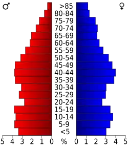 Bevolkingspiramide White County | |||
| Statistieken volkstelling White County | |||
| |||
White County is een county in de Amerikaanse staat Indiana.
De county heeft een landoppervlakte van 1.309 km² en telt 25.267 inwoners (volkstelling 2000). De hoofdplaats is Monticello.
Bevolkingsontwikkeling
| Jaar | Inwoners | % ± | |
|---|---|---|---|
| 1900 | 19.138 | — | |
| 1910 | 17.602 | −8,0% | |
| 1920 | 17.351 | −1,4% | |
| 1930 | 15.831 | −8,8% | |
| 1940 | 17.037 | 7,6% | |
| 1950 | 18.042 | 5,9% | |
| 1960 | 19.709 | 9,2% | |
| 1970 | 20.995 | 6,5% | |
| 1980 | 23.867 | 13,7% | |
| 1990 | 23.265 | −2,5% | |
| 2000 | 25.267 | 8,6% | |
| Bron: (en) Historical Decennial Census Population | |||