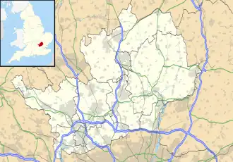
Weston (Hertfordshire)
| Civil parish in Engeland | |||
|---|---|---|---|
 | |||
| Situering | |||
| Regio | East of England | ||
| Graafschap | Hertfordshire | ||
| District | North Hertfordshire | ||
| Coördinaten | 51° 57' NB, 0° 10' WL | ||
| Algemeen | |||
| Oppervlakte | 17,1414 km² | ||
| Inwoners (2011) |
1054 (61 inw./km²) | ||
| Overig | |||
| Postcode(s) | SG4 | ||
| Grid code | TL260303 | ||
| Post town | HITCHIN | ||
| ONS-code | E04004799 | ||
| Foto's | |||
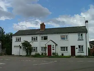
| |||
| Cottages in Weston | |||
| |||
Weston is een civil parish in het bestuurlijke gebied North Hertfordshire, in het Engelse graafschap Hertfordshire.
-
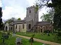 Holy Trinity
Bronnen, noten en/of referenties
Geplaatst op:
13-8-2010
13-8-2010
Dit artikel is een beginnetje over landen & volken. U wordt uitgenodigd om op bewerken te klikken om uw kennis aan dit artikel toe te voegen.