West Quantoxhead
| Civil parish in Engeland | |||
|---|---|---|---|
 | |||
| Situering | |||
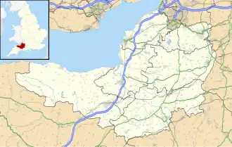
| Regio | South West England | ||
| Graafschap | Somerset | ||
| District | Somerset West and Taunton | ||
| Coördinaten | 51° 10' NB, 3° 16' WL | ||
| Algemeen | |||
| Oppervlakte | 6,0902 km² | ||
| Inwoners (2011) |
343 (56 inw./km²) | ||
| Overig | |||
| Postcode(s) | TA4 | ||
| Netnummer(s) | 01984 | ||
| Grid code | ST113420 | ||
| Post town | WILLITON | ||
| ONS-code | E04008863 | ||
| Foto's | |||
| |||
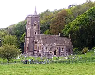
| Kerk van St. Audries | |||
| |||
West Quantoxhead is een civil parish in het bestuurlijke gebied Somerset West and Taunton, in het Engelse graafschap Somerset met 343 inwoners.
Bronnen, noten en/of referenties
Geplaatst op:
31-7-2010
31-7-2010
Dit artikel is een beginnetje over landen & volken. U wordt uitgenodigd om op bewerken te klikken om uw kennis aan dit artikel toe te voegen.