West Keal
| Civil parish in Engeland | |||
|---|---|---|---|
 | |||
| Situering | |||
| Regio | East Midlands | ||
| Graafschap | Lincolnshire | ||
| District | East Lindsey | ||
| Coördinaten | 53° 9' NB, 0° 3' OL | ||
| Algemeen | |||
| Oppervlakte | 8,1024 km² | ||
| Inwoners (2011) |
327 (40 inw./km²) | ||
| Overig | |||
| ONS-code | E04005763 | ||
| Foto's | |||
| |||
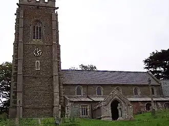
| Anglicaanse Kerk | |||
| |||
West Keal is een civil parish in het bestuurlijke gebied East Lindsey, in het Engelse graafschap Lincolnshire. In 2001 telde het dorp 333 inwoners.[1] West Keal komt in het Domesday Book (1086) voor als 'Cale' / 'Westrecale'.[2]
Het gehucht Keal Cotes maakt deel uit van de parish en ligt ongeveer halverwege West Keal en Stickford.
Externe link
Bronnen, noten en/of referenties
- ↑ (en) 'Office for National Statistics', geraadpleegd 22 juni 2014.
- ↑ (en) domesdaybook.co.uk, geraadpleegd 22 juni 2014.