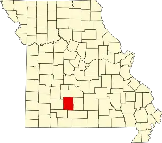
Webster County (Missouri)
| County in de Verenigde Staten | |||
|---|---|---|---|
| |||
| Situering | |||
| Staat | Missouri | ||
| Coördinaten | 37°16'48"NB, 92°52'12"WL | ||
| Algemeen | |||
| Oppervlakte | 1.538 km² | ||
| - land | 1.537 km² | ||
| - water | 1 km² | ||
| Inwoners (2000) |
31.045 (20 inw./km²) | ||
| Overig | |||
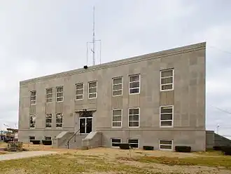
| Zetel | Marshfield | ||
| FIPS-code | 29225 | ||
| Opgericht | 1855 | ||
| Website | www | ||
| Foto's | |||
| |||
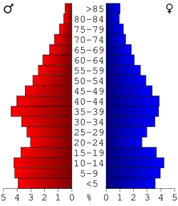 Bevolkingspiramide Webster County | |||
| Statistieken volkstelling Webster County | |||
| |||
Webster County is een county in de Amerikaanse staat Missouri.
De county heeft een landoppervlakte van 1.537 km² en telt 31.045 inwoners (volkstelling 2000). De hoofdplaats is Marshfield.
Bevolkingsontwikkeling
| Jaar | Inwoners | % ± | |
|---|---|---|---|
| 1900 | 16.640 | — | |
| 1910 | 17.377 | 4,4% | |
| 1920 | 16.609 | −4,4% | |
| 1930 | 16.148 | −2,8% | |
| 1940 | 17.226 | 6,7% | |
| 1950 | 15.072 | −12,5% | |
| 1960 | 13.753 | −8,8% | |
| 1970 | 15.562 | 13,2% | |
| 1980 | 20.414 | 31,2% | |
| 1990 | 23.753 | 16,4% | |
| 2000 | 31.045 | 30,7% | |
| Bron: (en) Historical Decennial Census Population | |||