Wayne County (Indiana)
| County in de Verenigde Staten | |||
|---|---|---|---|
| |||
| Situering | |||
| Staat | Indiana | ||
| Coördinaten | 39°51'36"NB, 85°0'36"WL | ||
| Algemeen | |||
| Oppervlakte | 1.047 km² | ||
| - land | 1.045 km² | ||
| - water | 2 km² | ||
| Inwoners (2000) |
71.097 (68 inw./km²) | ||
| Overig | |||
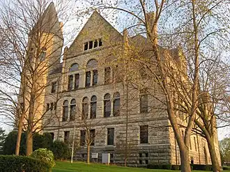
| Zetel | Richmond | ||
| FIPS-code | 18177 | ||
| Opgericht | 1810 | ||
| Website | co | ||
| Foto's | |||
| |||
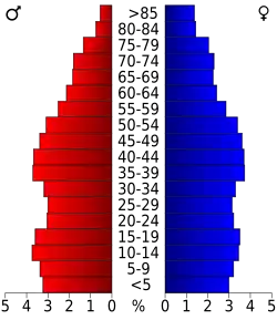 Bevolkingspiramide Wayne County | |||
| Statistieken volkstelling Wayne County | |||
| |||
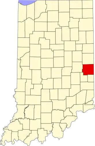
Wayne County is een county in de Amerikaanse staat Indiana.
De county heeft een landoppervlakte van 1.045 km² en telt 71.097 inwoners (volkstelling 2000). De hoofdplaats is Richmond.
In Wayne County ligt het hoogste punt van de staat Indiana: Hoosier Hill.
Bevolkingsontwikkeling
| Jaar | Inwoners | % ± | |
|---|---|---|---|
| 1900 | 38.970 | — | |
| 1910 | 43.757 | 12,3% | |
| 1920 | 48.136 | 10,0% | |
| 1930 | 54.809 | 13,9% | |
| 1940 | 59.229 | 8,1% | |
| 1950 | 68.566 | 15,8% | |
| 1960 | 74.039 | 8,0% | |
| 1970 | 79.109 | 6,8% | |
| 1980 | 76.058 | −3,9% | |
| 1990 | 71.951 | −5,4% | |
| 2000 | 71.097 | −1,2% | |
| Bron: (en) Historical Decennial Census Population | |||