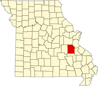
Washington County (Missouri)
| County in de Verenigde Staten | |||
|---|---|---|---|
| |||
| Situering | |||
| Staat | Missouri | ||
| Coördinaten | 37°58'12"NB, 90°52'48"WL | ||
| Algemeen | |||
| Oppervlakte | 1.974 km² | ||
| - land | 1.967 km² | ||
| - water | 7 km² | ||
| Inwoners (2000) |
23.344 (12 inw./km²) | ||
| Overig | |||
| Zetel | Potosi | ||
| FIPS-code | 29221 | ||
| Opgericht | 1813 | ||
| Website | www | ||
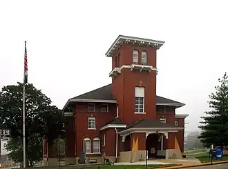
| Foto's | |||
| |||
 Bevolkingspiramide Washington County | |||
| Statistieken volkstelling Washington County | |||
| |||
Washington County is een county in de Amerikaanse staat Missouri.
De county heeft een landoppervlakte van 1.967 km² en telt 23.344 inwoners (volkstelling 2000). De hoofdplaats is Potosi.
Bevolkingsontwikkeling
| Jaar | Inwoners | % ± | |
|---|---|---|---|
| 1900 | 14.263 | — | |
| 1910 | 13.378 | −6,2% | |
| 1920 | 13.803 | 3,2% | |
| 1930 | 14.450 | 4,7% | |
| 1940 | 17.492 | 21,1% | |
| 1950 | 14.689 | −16,0% | |
| 1960 | 14.346 | −2,3% | |
| 1970 | 15.086 | 5,2% | |
| 1980 | 17.983 | 19,2% | |
| 1990 | 20.380 | 13,3% | |
| 2000 | 23.344 | 14,5% | |
| Bron: (en) Historical Decennial Census Population | |||