Warren County (Georgia)
| County in de Verenigde Staten | |||
|---|---|---|---|
| |||
| Situering | |||
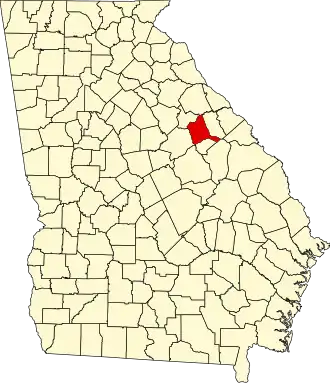
| Staat | Georgia | ||
| Coördinaten | 33°24'36"NB, 82°40'48"WL | ||
| Algemeen | |||
| Oppervlakte | 742 km² | ||
| - land | 739 km² | ||
| - water | 3 km² | ||
| Inwoners (2000) |
6.336 (9 inw./km²) | ||
| Overig | |||
| Zetel | Warrenton | ||
| FIPS-code | 13301 | ||
| Opgericht | 1793 | ||
| Website | www | ||
| Foto's | |||

| |||
 Bevolkingspiramide Warren County | |||
| Statistieken volkstelling Warren County | |||
| |||
Warren County is een county in de Amerikaanse staat Georgia.
De county heeft een landoppervlakte van 739 km² en telt 6.336 inwoners (volkstelling 2000). De hoofdplaats is Warrenton.
Bevolkingsontwikkeling
| Jaar | Inwoners | % ± | |
|---|---|---|---|
| 1900 | 11.463 | — | |
| 1910 | 11.860 | 3,5% | |
| 1920 | 11.828 | −0,3% | |
| 1930 | 11.181 | −5,5% | |
| 1940 | 10.236 | −8,5% | |
| 1950 | 8.779 | −14,2% | |
| 1960 | 7.360 | −16,2% | |
| 1970 | 6.669 | −9,4% | |
| 1980 | 6.583 | −1,3% | |
| 1990 | 6.078 | −7,7% | |
| 2000 | 6.336 | 4,2% | |
| Bron: (en) Historical Decennial Census Population | |||