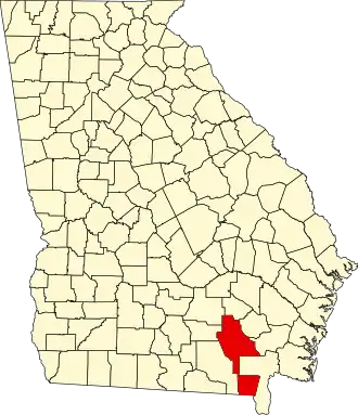
Ware County
| County in de Verenigde Staten | |||
|---|---|---|---|
| |||
| Situering | |||
| Staat | Georgia | ||
| Coördinaten | 31°3'0"NB, 82°25'12"WL | ||
| Algemeen | |||
| Oppervlakte | 2.347 km² | ||
| - land | 2.337 km² | ||
| - water | 10 km² | ||
| Inwoners (2000) |
35.483 (15 inw./km²) | ||
| Overig | |||
| Zetel | Waycross | ||
| FIPS-code | 13299 | ||
| Opgericht | 1824 | ||
| Website | www | ||
| Foto's | |||

| |||
 Bevolkingspiramide Ware County | |||
| Statistieken volkstelling Ware County | |||
| |||
Ware County is een county in de Amerikaanse staat Georgia.
De county heeft een landoppervlakte van 2.337 km² en telt 35.483 inwoners (volkstelling 2000). De hoofdplaats is Waycross. Het Okefenokee National Wildlife Refuge ligt gedeeltelijk in de county.
Bevolkingsontwikkeling
| Jaar | Inwoners | % ± | |
|---|---|---|---|
| 1900 | 13.761 | — | |
| 1910 | 22.957 | 66,8% | |
| 1920 | 28.361 | 23,5% | |
| 1930 | 26.558 | −6,4% | |
| 1940 | 27.929 | 5,2% | |
| 1950 | 30.289 | 8,4% | |
| 1960 | 34.219 | 13,0% | |
| 1970 | 33.525 | −2,0% | |
| 1980 | 37.180 | 10,9% | |
| 1990 | 35.471 | −4,6% | |
| 2000 | 35.483 | 0,0% | |
| Bron: (en) Historical Decennial Census Population | |||