Walker County (Georgia)
| County in de Verenigde Staten | |||
|---|---|---|---|
| |||
| Situering | |||
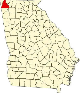
| Staat | Georgia | ||
| Coördinaten | 34°43'48"NB, 85°18'0"WL | ||
| Algemeen | |||
| Oppervlakte | 1.158 km² | ||
| - land | 1.157 km² | ||
| - water | 1 km² | ||
| Inwoners (2000) |
61.053 (53 inw./km²) | ||
| Overig | |||
| Zetel | LaFayette | ||
| FIPS-code | 13295 | ||
| Opgericht | 1833 | ||
| Website | www | ||
| Foto's | |||
_Courthouse.jpg)
| |||
 Bevolkingspiramide Walker County | |||
| Statistieken volkstelling Walker County | |||
| |||
Walker County is een county in de Amerikaanse staat Georgia.
De county heeft een landoppervlakte van 1.157 km² en telt 61.053 inwoners (volkstelling 2000). De hoofdplaats is LaFayette.
Bevolkingsontwikkeling
| Jaar | Inwoners | % ± | |
|---|---|---|---|
| 1900 | 15.661 | — | |
| 1910 | 18.692 | 19,4% | |
| 1920 | 23.370 | 25,0% | |
| 1930 | 26.206 | 12,1% | |
| 1940 | 31.024 | 18,4% | |
| 1950 | 38.198 | 23,1% | |
| 1960 | 45.264 | 18,5% | |
| 1970 | 50.691 | 12,0% | |
| 1980 | 56.470 | 11,4% | |
| 1990 | 58.340 | 3,3% | |
| 2000 | 61.053 | 4,7% | |
| Bron: (en) Historical Decennial Census Population | |||