Wabaunsee County
| County in de Verenigde Staten | |||
|---|---|---|---|
| |||
| Situering | |||
| Staat | Kansas | ||
| Coördinaten | 39°1'7"NB, 96°17'33"WL | ||
| Algemeen | |||
| Oppervlakte | 2.071 km² | ||
| - land | 2.065 km² | ||
| - water | 6 km² | ||
| Inwoners (2000) |
6.885 (3 inw./km²) | ||
| Overig | |||
| Zetel | Alma | ||
| FIPS-code | 20197 | ||
| Opgericht | 1855 | ||
| Website | wabaunsee | ||
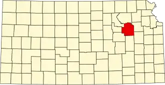
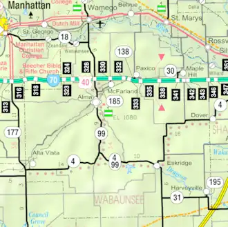
| Detailkaart | |||
| |||
| Overzichtskaart van Wabaunsee County | |||
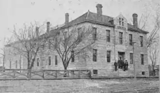
| Foto's | |||

| |||
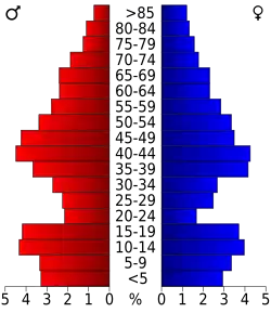 Bevolkingspiramide Wabaunsee County | |||
| Statistieken volkstelling Wabaunsee County | |||
| |||
Wabaunsee County is een county in de Amerikaanse staat Kansas.
De county heeft een landoppervlakte van 2.065 km² en telt 6.885 inwoners (volkstelling 2000). De hoofdplaats is Alma.
Bevolkingsontwikkeling
| Jaar | Inwoners | % ± | |
|---|---|---|---|
| 1900 | 12.813 | — | |
| 1910 | 12.721 | −0,7% | |
| 1920 | 11.424 | −10,2% | |
| 1930 | 10.830 | −5,2% | |
| 1940 | 9.219 | −14,9% | |
| 1950 | 7.212 | −21,8% | |
| 1960 | 6.648 | −7,8% | |
| 1970 | 6.397 | −3,8% | |
| 1980 | 6.867 | 7,3% | |
| 1990 | 6.603 | −3,8% | |
| 2000 | 6.885 | 4,3% | |
| Bron: (en) Historical Decennial Census Population | |||