Union County (Georgia)
| County in de Verenigde Staten | |||
|---|---|---|---|

| |||
| Situering | |||
| Staat | Georgia | ||
| Coördinaten | 34°49'48"NB, 83°59'24"WL | ||
| Algemeen | |||
| Oppervlakte | 852 km² | ||
| - land | 835 km² | ||
| - water | 17 km² | ||
| Inwoners (2000) |
17.289 (21 inw./km²) | ||
| Overig | |||
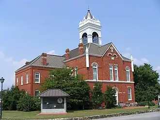
| Zetel | Blairsville | ||
| FIPS-code | 13291 | ||
| Opgericht | 1832 | ||
| Website | www | ||
| Foto's | |||
| |||
 Bevolkingspiramide Union County | |||
| Statistieken volkstelling Union County | |||
| |||
Union County is een county in de Amerikaanse staat Georgia.
De county heeft een landoppervlakte van 835 km² en telt 17.289 inwoners (volkstelling 2000). De hoofdplaats is Blairsville.
Bevolkingsontwikkeling
| Jaar | Inwoners | % ± | |
|---|---|---|---|
| 1900 | 8.481 | — | |
| 1910 | 6.918 | −18,4% | |
| 1920 | 6.455 | −6,7% | |
| 1930 | 6.340 | −1,8% | |
| 1940 | 7.680 | 21,1% | |
| 1950 | 7.318 | −4,7% | |
| 1960 | 6.510 | −11,0% | |
| 1970 | 6.811 | 4,6% | |
| 1980 | 9.390 | 37,9% | |
| 1990 | 11.993 | 27,7% | |
| 2000 | 17.289 | 44,2% | |
| Bron: (en) Historical Decennial Census Population | |||