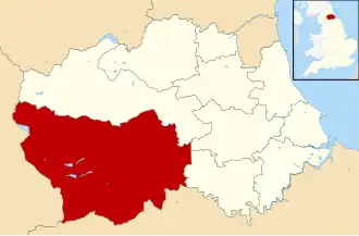
Teesdale (district)
| District in Engeland | |||
|---|---|---|---|
| |||
| Situering | |||
| Land | Engeland | ||
| County | Durham | ||
| Regio | North East England | ||
| Coördinaten | 54°32'42"NB, 1°55'37"WL | ||
| Algemeen | |||
| Oppervlakte | 836,2 km² | ||
| Inwoners (2001) |
24.457 (29 inw./km²) | ||
| ONS-code | 20UH | ||
| Website | www | ||
| |||
Teesdale was tot 1 april 2009 een Engels district in het graafschap Durham en telt 24.457 inwoners. De oppervlakte bedraagt 836,2 km². Hoofdplaats is Barnard Castle.
Van de bevolking is 19,2% ouder dan 65 jaar. De werkloosheid bedraagt 2,7% van de beroepsbevolking (cijfers volkstelling 2001).
Bronnen, noten en/of referenties