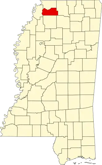
Tate County
| County in de Verenigde Staten | |||
|---|---|---|---|
| |||
| Situering | |||
| Staat | Mississippi | ||
| Coördinaten | 34°39'0"NB, 89°56'24"WL | ||
| Algemeen | |||
| Oppervlakte | 1.065 km² | ||
| - land | 1.048 km² | ||
| - water | 17 km² | ||
| Inwoners (2000) |
25.370 (24 inw./km²) | ||
| Overig | |||
| Zetel | Senatobia | ||
| FIPS-code | 28137 | ||
| Opgericht | 1873 | ||
| Website | www | ||
| Foto's | |||

| |||
 Bevolkingspiramide Tate County | |||
| Statistieken volkstelling Tate County | |||
| |||
Tate County is een county in de Amerikaanse staat Mississippi.
De county heeft een landoppervlakte van 1.048 km² en telt 25.370 inwoners (volkstelling 2000). De hoofdplaats is Senatobia.
Bevolkingsontwikkeling
| Jaar | Inwoners | % ± | |
|---|---|---|---|
| 1900 | 20.618 | — | |
| 1910 | 19.714 | −4,4% | |
| 1920 | 19.636 | −0,4% | |
| 1930 | 17.671 | −10,0% | |
| 1940 | 19.309 | 9,3% | |
| 1950 | 18.011 | −6,7% | |
| 1960 | 18.138 | 0,7% | |
| 1970 | 18.544 | 2,2% | |
| 1980 | 20.119 | 8,5% | |
| 1990 | 21.432 | 6,5% | |
| 2000 | 25.370 | 18,4% | |
| Bron: (en) Historical Decennial Census Population | |||