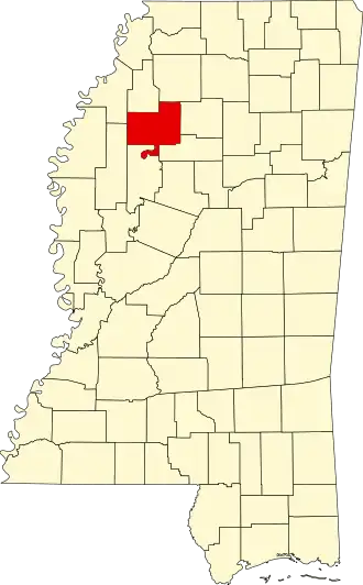
Tallahatchie County
| County in de Verenigde Staten | |||
|---|---|---|---|
| |||
| Situering | |||
| Staat | Mississippi | ||
| Coördinaten | 33°57'0"NB, 90°10'12"WL | ||
| Algemeen | |||
| Oppervlakte | 1.689 km² | ||
| - land | 1.668 km² | ||
| - water | 21 km² | ||
| Inwoners (2000) |
14.903 (9 inw./km²) | ||
| Overig | |||
| Zetel | Charleston | ||
| FIPS-code | 28135 | ||
| Opgericht | 1833 | ||
| Foto's | |||

| |||
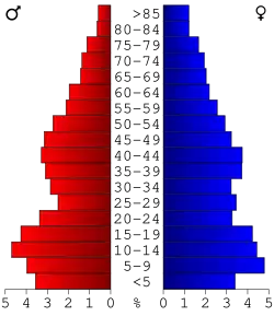 Bevolkingspiramide Tallahatchie County | |||
| Statistieken volkstelling Tallahatchie County | |||
| |||
Tallahatchie County is een county in de Amerikaanse staat Mississippi.
De county heeft een landoppervlakte van 1.668 km² en telt 14.903 inwoners (volkstelling 2000). De hoofdplaats is Charleston.
Bevolkingsontwikkeling
| Jaar | Inwoners | % ± | |
|---|---|---|---|
| 1900 | 19.600 | — | |
| 1910 | 29.078 | 48,4% | |
| 1920 | 35.953 | 23,6% | |
| 1930 | 35.568 | −1,1% | |
| 1940 | 34.166 | −3,9% | |
| 1950 | 30.486 | −10,8% | |
| 1960 | 24.081 | −21,0% | |
| 1970 | 19.338 | −19,7% | |
| 1980 | 17.157 | −11,3% | |
| 1990 | 15.210 | −11,3% | |
| 2000 | 14.903 | −2,0% | |
| Bron: (en) Historical Decennial Census Population | |||