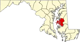
Talbot County (Maryland)
| County in de Verenigde Staten | |||
|---|---|---|---|
| |||
| Situering | |||
| Staat | Maryland | ||
| Coördinaten | 38°45'0"NB, 76°10'48"WL | ||
| Algemeen | |||
| Oppervlakte | 1.235 km² | ||
| - land | 697 km² | ||
| - water | 538 km² | ||
| Inwoners (2000) |
33.812 (49 inw./km²) | ||
| Overig | |||
| Zetel | Easton (Maryland) | ||
| FIPS-code | 24041 | ||
| Opgericht | 1661 | ||
| Website | www | ||
| Foto's | |||

| |||
 Bevolkingspiramide Talbot County | |||
| Statistieken volkstelling Talbot County | |||
| |||
Talbot County is een county in de Amerikaanse staat Maryland.
De county heeft een landoppervlakte van 697 km² en telt 33.812 inwoners (volkstelling 2000). De hoofdplaats is Easton (Maryland).
Bevolkingsontwikkeling
| Jaar | Inwoners | % ± | |
|---|---|---|---|
| 1900 | 20.342 | — | |
| 1910 | 19.620 | −3,5% | |
| 1920 | 18.306 | −6,7% | |
| 1930 | 18.583 | 1,5% | |
| 1940 | 18.784 | 1,1% | |
| 1950 | 19.428 | 3,4% | |
| 1960 | 21.578 | 11,1% | |
| 1970 | 23.682 | 9,8% | |
| 1980 | 25.604 | 8,1% | |
| 1990 | 30.549 | 19,3% | |
| 2000 | 33.812 | 10,7% | |
| Bron: (en) Historical Decennial Census Population | |||