Talbot County (Georgia)
| County in de Verenigde Staten | |||
|---|---|---|---|
| |||
| Situering | |||
| Staat | Georgia | ||
| Coördinaten | 32°42'36"NB, 84°31'48"WL | ||
| Algemeen | |||
| Oppervlakte | 1.022 km² | ||
| - land | 1.018 km² | ||
| - water | 4 km² | ||
| Inwoners (2000) |
6.498 (6 inw./km²) | ||
| Overig | |||
| Zetel | Talbotton | ||
| FIPS-code | 13263 | ||
| Opgericht | 1827 | ||
| Website | talbotcountyga | ||
| Foto's | |||

| |||
 Bevolkingspiramide Talbot County | |||
| Statistieken volkstelling Talbot County | |||
| |||
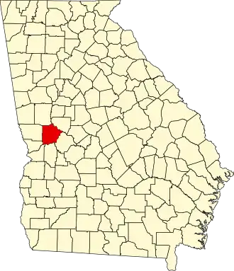
Talbot County is een county in de Amerikaanse staat Georgia.
De county heeft een landoppervlakte van 1.018 km² en telt 6.498 inwoners (volkstelling 2000). De hoofdplaats is Talbotton.
Bevolkingsontwikkeling
| Jaar | Inwoners | % ± | |
|---|---|---|---|
| 1900 | 12.197 | — | |
| 1910 | 11.696 | −4,1% | |
| 1920 | 11.158 | −4,6% | |
| 1930 | 8.458 | −24,2% | |
| 1940 | 8.141 | −3,7% | |
| 1950 | 7.687 | −5,6% | |
| 1960 | 7.127 | −7,3% | |
| 1970 | 6.625 | −7,0% | |
| 1980 | 6.536 | −1,3% | |
| 1990 | 6.524 | −0,2% | |
| 2000 | 6.498 | −0,4% | |
| Bron: (en) Historical Decennial Census Population | |||