Sunk Island
| Civil parish in Engeland | |||
|---|---|---|---|
 | |||
| Situering | |||
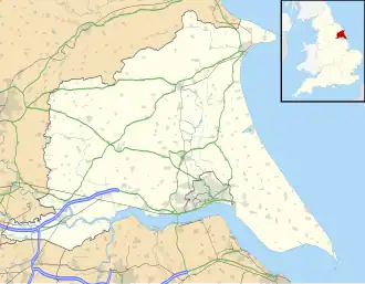
| Regio | Yorkshire and the Humber | ||
| Graafschap | East Riding of Yorkshire | ||
| District | East Riding of Yorkshire | ||
| Coördinaten | 53° 39' NB, 0° 5' WL | ||
| Algemeen | |||
| Oppervlakte | 30,2481 km² | ||
| Inwoners (2011) |
228 (7,5 inw./km²) | ||
| Overig | |||
| Postcode(s) | HU12 | ||
| Netnummer(s) | 01964 | ||
| Grid code | TA267190 | ||
| Post town | HULL | ||
| ONS-code | E04000482 | ||
| Foto's | |||

| |||
| Holy Trinity Church, Sunk Island | |||
| |||
Sunk Island is een civil parish in het bestuurlijke gebied East Riding of Yorkshire, in het Engelse graafschap East Riding of Yorkshire met 228 inwoners.
Geplaatst op:
2-8-2010
2-8-2010
Dit artikel is een beginnetje over landen & volken. U wordt uitgenodigd om op bewerken te klikken om uw kennis aan dit artikel toe te voegen.