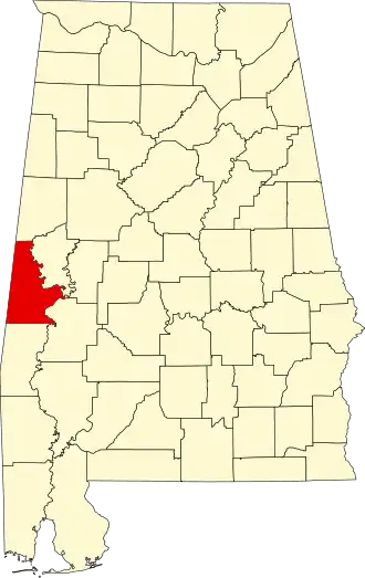
Sumter County (Alabama)
| County in de Verenigde Staten | |||
|---|---|---|---|
| |||
| Situering | |||
| Staat | Alabama | ||
| Coördinaten | 32°35'30"NB, 88°12'15"WL | ||
| Algemeen | |||
| Oppervlakte | 2.366 km² | ||
| - land | 2.344 km² | ||
| - water | 22 km² | ||
| Inwoners (2000) |
14.798 (6 inw./km²) | ||
| Overig | |||
| Zetel | Livingston | ||
| FIPS-code | 01119 | ||
| Opgericht | 1832 | ||
| Website | sumtercountyal | ||
| Foto's | |||

| |||
 Bevolkingspiramide Sumter County | |||
| Statistieken volkstelling Sumter County | |||
| |||
Sumter County is een county in de Amerikaanse staat Alabama.
De county heeft een landoppervlakte van 2.344 km² en telt 14.798 inwoners (volkstelling 2000). De hoofdplaats is Livingston.
Bevolkingsontwikkeling
| Jaar | Inwoners | % ± | |
|---|---|---|---|
| 1900 | 32.710 | — | |
| 1910 | 28.699 | −12,3% | |
| 1920 | 25.569 | −10,9% | |
| 1930 | 26.929 | 5,3% | |
| 1940 | 27.321 | 1,5% | |
| 1950 | 23.610 | −13,6% | |
| 1960 | 20.041 | −15,1% | |
| 1970 | 16.974 | −15,3% | |
| 1980 | 16.908 | −0,4% | |
| 1990 | 16.174 | −4,3% | |
| 2000 | 14.798 | −8,5% | |
| Bron: (en) Historical Decennial Census Population | |||