Stone County (Missouri)
| County in de Verenigde Staten | |||
|---|---|---|---|
| |||
| Situering | |||
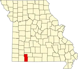
| Staat | Missouri | ||
| Coördinaten | 36°44'24"NB, 93°28'12"WL | ||
| Algemeen | |||
| Oppervlakte | 1.323 km² | ||
| - land | 1.200 km² | ||
| - water | 123 km² | ||
| Inwoners (2000) |
28.658 (24 inw./km²) | ||
| Overig | |||
| Zetel | Galena | ||
| FIPS-code | 29209 | ||
| Opgericht | 1851 | ||
| Website | www | ||
| Foto's | |||

| |||
 Bevolkingspiramide Stone County | |||
| Statistieken volkstelling Stone County | |||
| |||
Stone County is een county in de Amerikaanse staat Missouri.
De county heeft een landoppervlakte van 1.200 km² en telt 28.658 inwoners (volkstelling 2000). De hoofdplaats is Galena.
Bevolkingsontwikkeling
| Jaar | Inwoners | % ± | |
|---|---|---|---|
| 1900 | 9.892 | — | |
| 1910 | 11.559 | 16,9% | |
| 1920 | 11.941 | 3,3% | |
| 1930 | 11.614 | −2,7% | |
| 1940 | 11.298 | −2,7% | |
| 1950 | 9.748 | −13,7% | |
| 1960 | 8.176 | −16,1% | |
| 1970 | 9.921 | 21,3% | |
| 1980 | 15.587 | 57,1% | |
| 1990 | 19.078 | 22,4% | |
| 2000 | 28.658 | 50,2% | |
| Bron: (en) Historical Decennial Census Population | |||