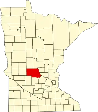
Stearns County
| County in de Verenigde Staten | |||
|---|---|---|---|
| |||
| Situering | |||
| Staat | Minnesota | ||
| Coördinaten | 45°33'0"NB, 94°36'36"WL | ||
| Algemeen | |||
| Oppervlakte | 3.600 km² | ||
| - land | 3.482 km² | ||
| - water | 118 km² | ||
| Inwoners (2000) |
133.166 (38 inw./km²) | ||
| Overig | |||
| Zetel | St. Cloud | ||
| FIPS-code | 27145 | ||
| Opgericht | 1855 | ||
| Website | www | ||
| Foto's | |||

| |||
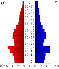 Bevolkingspiramide Stearns County | |||
| Statistieken volkstelling Stearns County | |||
| |||
Stearns County is een county in de Amerikaanse staat Minnesota.
De county heeft een landoppervlakte van 3.482 km² en telt 133.166 inwoners (volkstelling 2000). De hoofdplaats is St. Cloud.
Bevolkingsontwikkeling
| Jaar | Inwoners | % ± | |
|---|---|---|---|
| 1900 | 44.464 | — | |
| 1910 | 47.733 | 7,4% | |
| 1920 | 55.741 | 16,8% | |
| 1930 | 62.121 | 11,4% | |
| 1940 | 67.200 | 8,2% | |
| 1950 | 70.681 | 5,2% | |
| 1960 | 80.345 | 13,7% | |
| 1970 | 95.400 | 18,7% | |
| 1980 | 108.161 | 13,4% | |
| 1990 | 118.791 | 9,8% | |
| 2000 | 133.166 | 12,1% | |
| Bron: (en) Historical Decennial Census Population | |||