Stapleton (Richmondshire)
| Civil parish in Engeland | |||
|---|---|---|---|
.svg.png) | |||
| Situering | |||
| Regio | Yorkshire and the Humber | ||
| Graafschap | North Yorkshire | ||
| District | Richmondshire | ||
| Coördinaten | 54° 30' NB, 1° 36' WL | ||
| Algemeen | |||
| Oppervlakte | 4,0726 km² | ||
| Inwoners (2011) |
179 (44 inw./km²) | ||
| Overig | |||
| Postcode(s) | DL2 2 | ||
| Grid code | NZ263121 | ||
| ONS-code | E04007528 | ||
| Foto's | |||
| |||
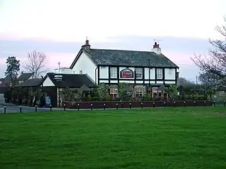
| De Bridge Inn | |||
| |||
Stapleton is een civil parish in het Engelse graafschap North Yorkshire. In 2001 telde het dorp 211 inwoners.[1]
Bronnen
Bronnen, noten en/of referenties
Geplaatst op:
15-8-2010
15-8-2010
Dit artikel is een beginnetje over landen & volken. U wordt uitgenodigd om op bewerken te klikken om uw kennis aan dit artikel toe te voegen.