Stalham
| Civil parish in Engeland | |||
|---|---|---|---|
 | |||
| Situering | |||
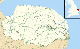
| Regio | East of England | ||
| Graafschap | Norfolk | ||
| District | North Norfolk | ||
| Coördinaten | 52° 46' NB, 1° 31' OL | ||
| Algemeen | |||
| Oppervlakte | 7,2985 km² | ||
| Inwoners (2011) |
3149 (431 inw./km²) | ||
| Overig | |||
| Postcode(s) | NR12 | ||
| Grid code | TG3725 | ||
| Post town | NORWICH | ||
| ONS-code | E04006474 | ||
| Foto's | |||
.JPG)
| |||
| High Street | |||
| |||
Stalham is een marktstad en civil parish (inwonertal 2951[1]) in het bestuurlijke gebied North Norfolk, in het Engelse graafschap Norfolk. De plaats ligt in de Norfolk Broads, ongeveer 20 km van Norwich aan de A149.
-
 Gemeentehuis
Bronnen, noten en/of referenties
- ↑ Office for National Statistics & Norfolk County Council, 2001. "Census population and household counts for unparished urban areas and all parishes."