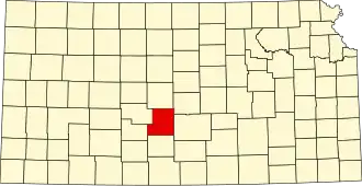
Stafford County (Kansas)
| County in de Verenigde Staten | |||
|---|---|---|---|
| |||
| Situering | |||
| Staat | Kansas | ||
| Coördinaten | 38°4'0,1"NB, 98°43'0,1"WL | ||
| Algemeen | |||
| Oppervlakte | 2.058 km² | ||
| - land | 2.051 km² | ||
| - water | 7 km² | ||
| Inwoners (2000) |
4.789 (2 inw./km²) | ||
| Overig | |||
| Zetel | St. John | ||
| FIPS-code | 20185 | ||
| Opgericht | 1873 | ||
| Website | staffordcounty | ||
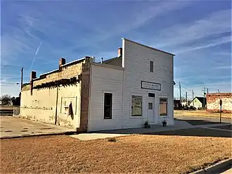
| Foto's | |||
| |||
 Bevolkingspiramide Stafford County | |||
| Statistieken volkstelling Stafford County | |||
| |||
Stafford County is een county in de Amerikaanse staat Kansas.
De county heeft een landoppervlakte van 2.051 km² en telt 4.789 inwoners (volkstelling 2000). De hoofdplaats is St. John.
Bevolkingsontwikkeling
| Jaar | Inwoners | % ± | |
|---|---|---|---|
| 1900 | 9.829 | — | |
| 1910 | 12.510 | 27,3% | |
| 1920 | 11.559 | −7,6% | |
| 1930 | 10.460 | −9,5% | |
| 1940 | 10.487 | 0,3% | |
| 1950 | 8.816 | −15,9% | |
| 1960 | 7.451 | −15,5% | |
| 1970 | 5.943 | −20,2% | |
| 1980 | 5.694 | −4,2% | |
| 1990 | 5.365 | −5,8% | |
| 2000 | 4.789 | −10,7% | |
| Bron: (en) Historical Decennial Census Population | |||
Foto's
-
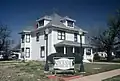 Historisch huis