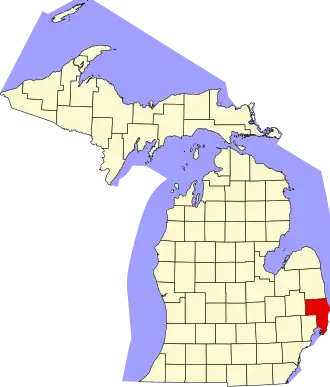
St. Clair County (Michigan)
| County in de Verenigde Staten | |||
|---|---|---|---|
| |||
| Situering | |||
| Staat | Michigan | ||
| Coördinaten | 42°55'48"NB, 82°40'12"WL | ||
| Algemeen | |||
| Oppervlakte | 2.167 km² | ||
| - land | 1.876 km² | ||
| - water | 291 km² | ||
| Inwoners (2000) |
164.235 (88 inw./km²) | ||
| Overig | |||
| Zetel | Port Huron | ||
| FIPS-code | 26147 | ||
| Opgericht | 1820 | ||
| Website | www | ||
| Foto's | |||

| |||
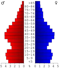 Bevolkingspiramide St. Clair County | |||
| Statistieken volkstelling St. Clair County | |||
| |||
St. Clair County is een county in de Amerikaanse staat Michigan.
De county heeft een landoppervlakte van 1.876 km² en telt 164.235 inwoners (volkstelling 2000). De hoofdplaats is Port Huron.
Bevolkingsontwikkeling
| Jaar | Inwoners | % ± | |
|---|---|---|---|
| 1900 | 55.228 | — | |
| 1910 | 52.341 | −5,2% | |
| 1920 | 58.009 | 10,8% | |
| 1930 | 67.563 | 16,5% | |
| 1940 | 76.222 | 12,8% | |
| 1950 | 91.599 | 20,2% | |
| 1960 | 107.201 | 17,0% | |
| 1970 | 120.175 | 12,1% | |
| 1980 | 138.802 | 15,5% | |
| 1990 | 145.607 | 4,9% | |
| 2000 | 164.235 | 12,8% | |
| Bron: (en) Historical Decennial Census Population | |||