Shire of Christmas Island
| Local Government Area van Australië | |||
|---|---|---|---|
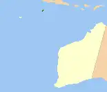 Locatie van Shire of Christmas Island ten opzichte van West-Australië
| |||
| Situering | |||
| Staat | West-Australië | ||
| Hoofdplaats | Christmaseiland | ||
| Coördinaten | 10°29'ZB, 105°37'OL | ||
| Algemene informatie | |||
| Oppervlakte | 137 km² | ||
| Inwoners | 1.692 (census 2021)[1] | ||
| Overig | |||
| Wards | geen | ||
| Website | http://www.shire.gov.cx | ||
| |||
Shire of Christmas Island is een Local Government Area (LGA) van het Australische externe territorium Christmaseiland. Deze LGA is sinds 1 juli 1992 bestuurlijk ingedeeld bij de staat West-Australië.
Bronnen, noten en/of referenties
- ↑ (en) Census 2021 Christmas Island LGA. ABS (2021). Geraadpleegd op 24 juli 2022.
Geplaatst op:
29-08-2008
29-08-2008
Dit artikel is een beginnetje over landen & volken. U wordt uitgenodigd om op bewerken te klikken om uw kennis aan dit artikel toe te voegen.