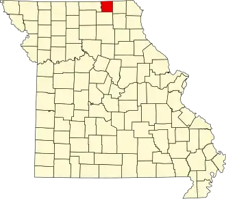
Schuyler County (Missouri)
| County in de Verenigde Staten | |||
|---|---|---|---|
| |||
| Situering | |||
| Staat | Missouri | ||
| Coördinaten | 40°28'12"NB, 92°31'12"WL | ||
| Algemeen | |||
| Oppervlakte | 798 km² | ||
| - land | 797 km² | ||
| - water | 1 km² | ||
| Inwoners (2000) |
4.170 (5 inw./km²) | ||
| Overig | |||
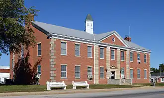
| Zetel | Lancaster | ||
| FIPS-code | 29197 | ||
| Opgericht | 1845 | ||
| Website | www | ||
| Foto's | |||
| |||
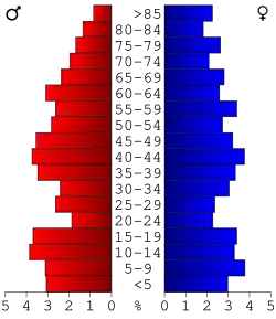 Bevolkingspiramide Schuyler County | |||
| Statistieken volkstelling Schuyler County | |||
| |||
Schuyler County is een county in de Amerikaanse staat Missouri.
De county heeft een landoppervlakte van 797 km² en telt 4.170 inwoners (volkstelling 2000). De hoofdplaats is Lancaster.
Bevolkingsontwikkeling
| Jaar | Inwoners | % ± | |
|---|---|---|---|
| 1900 | 10.840 | — | |
| 1910 | 9.062 | −16,4% | |
| 1920 | 8.383 | −7,5% | |
| 1930 | 6.951 | −17,1% | |
| 1940 | 6.627 | −4,7% | |
| 1950 | 5.760 | −13,1% | |
| 1960 | 5.052 | −12,3% | |
| 1970 | 4.665 | −7,7% | |
| 1980 | 4.979 | 6,7% | |
| 1990 | 4.236 | −14,9% | |
| 2000 | 4.170 | −1,6% | |
| Bron: (en) Historical Decennial Census Population | |||