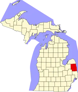
Sanilac County
| County in de Verenigde Staten | |||
|---|---|---|---|
| |||
| Situering | |||
| Staat | Michigan | ||
| Coördinaten | 43°27'36"NB, 82°38'24"WL | ||
| Algemeen | |||
| Oppervlakte | 4.118 km² | ||
| - land | 2.496 km² | ||
| - water | 1.622 km² | ||
| Inwoners (2000) |
44.547 (18 inw./km²) | ||
| Overig | |||
| Zetel | Sandusky | ||
| FIPS-code | 26151 | ||
| Opgericht | 1822 | ||
| Website | www | ||
| Foto's | |||
.jpg)
| |||
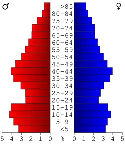 Bevolkingspiramide Sanilac County | |||
| Statistieken volkstelling Sanilac County | |||
| |||
Sanilac County is een county in de Amerikaanse staat Michigan.
De county heeft een landoppervlakte van 2.496 km² en telt 44.547 inwoners (volkstelling 2000). De hoofdplaats is Sandusky.
Bevolkingsontwikkeling
| Jaar | Inwoners | % ± | |
|---|---|---|---|
| 1900 | 35.055 | — | |
| 1910 | 33.930 | −3,2% | |
| 1920 | 31.237 | −7,9% | |
| 1930 | 27.751 | −11,2% | |
| 1940 | 30.114 | 8,5% | |
| 1950 | 30.837 | 2,4% | |
| 1960 | 32.314 | 4,8% | |
| 1970 | 34.889 | 8,0% | |
| 1980 | 40.789 | 16,9% | |
| 1990 | 39.928 | −2,1% | |
| 2000 | 44.547 | 11,6% | |
| Bron: (en) Historical Decennial Census Population | |||