São Francisco de Paula (Minas Gerais)
| Gemeente in Brazilië | |||
|---|---|---|---|
  | |||
 | |||
| Situering | |||
| Regio | Zuidoost | ||
| Staat | Minas Gerais | ||
| Mesoregio | Oeste de Minas | ||
| Microregio | Oliveira | ||
| Coördinaten | 20° 43′ ZB, 44° 59′ WL | ||
| Algemeen | |||
| Oppervlakte | 316,414 km² | ||
| Inwoners (2009) |
6.384 (21,5 inw./km²) | ||
| Hoogte | 931 m | ||
| Gemeentenummer | 3161205 | ||
| Politiek | |||
| Burgemeester | João Batista Lima | ||
| Gesticht | 1 maart 1963 | ||
| Overig | |||
| Tijdzone | UTC−3 | ||
| HDI | 0,714 | ||
| Website | Officiële website | ||
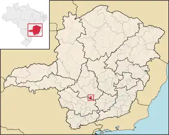
| Detailkaart | |||
| |||
| Locatie van São Francisco in de staat Minas Gerais | |||
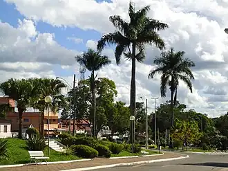
| Foto's | |||
| |||
| Straat in São Francisco de Paula | |||
| |||
São Francisco de Paula is een gemeente in de Braziliaanse deelstaat Minas Gerais. De gemeente telt 6.384 inwoners (schatting 2009).
Aangrenzende gemeenten
De gemeente grenst aan Camacho, Campo Belo, Candeias, Oliveira en Santana do Jacaré.
Bronnen, noten en/of referenties