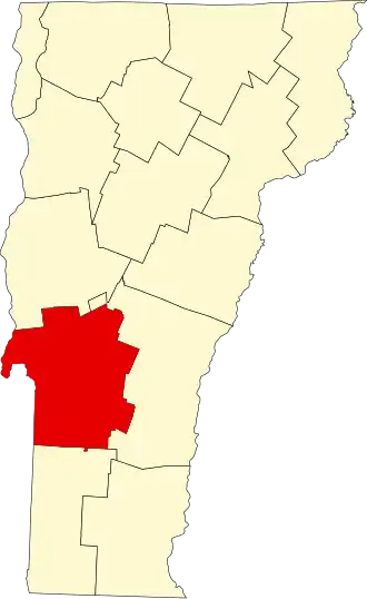
Rutland County
| County in de Verenigde Staten | |||
|---|---|---|---|
| |||
| Situering | |||
| Staat | Vermont | ||
| Tijdzone | Eastern Standard Time (UTC−5) | ||
| Coördinaten | 43°34'48,32"NB, 73°2'11,80"WL | ||
| Algemeen | |||
| Oppervlakte | 2.447 km² | ||
| - land | 2.415 km² | ||
| - water | 32 km² | ||
| Inwoners (2000) |
63.400 (26 inw./km²) | ||
| Overig | |||
| Zetel | Rutland | ||
| FIPS-code | 50021 | ||
| Opgericht | 1781 | ||
| Website | rutlandvermont | ||
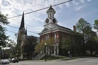
| Foto's | |||
| |||
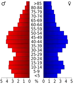 Bevolkingspiramide Rutland County | |||
| Statistieken volkstelling Rutland County | |||
| |||
Rutland County is een van de 14 county's in de Amerikaanse staat Vermont.
De county heeft een landoppervlakte van 2.415 km² en telt 63.400 inwoners (volkstelling 2000). De hoofdplaats is Rutland.
Bevolkingsontwikkeling
| Jaar | Inwoners | % ± | |
|---|---|---|---|
| 1900 | 44.209 | — | |
| 1910 | 48.139 | 8,9% | |
| 1920 | 46.213 | −4,0% | |
| 1930 | 48.453 | 4,8% | |
| 1940 | 45.638 | −5,8% | |
| 1950 | 45.905 | 0,6% | |
| 1960 | 46.719 | 1,8% | |
| 1970 | 52.637 | 12,7% | |
| 1980 | 58.347 | 10,8% | |
| 1990 | 62.142 | 6,5% | |
| 2000 | 63.400 | 2,0% | |
| Bron: (en) Historical Decennial Census Population | |||