Rockdale County
| County in de Verenigde Staten | |||
|---|---|---|---|
| |||
| Situering | |||
| Staat | Georgia | ||
| Coördinaten | 33°39'0"NB, 84°1'48"WL | ||
| Algemeen | |||
| Oppervlakte | 342 km² | ||
| - land | 338 km² | ||
| - water | 4 km² | ||
| Inwoners (2000) |
70.111 (207 inw./km²) | ||
| Overig | |||
| Zetel | Conyers | ||
| FIPS-code | 13247 | ||
| Opgericht | 1870 | ||
| Website | www | ||
| Foto's | |||

| |||
 Bevolkingspiramide Rockdale County | |||
| Statistieken volkstelling Rockdale County | |||
| |||
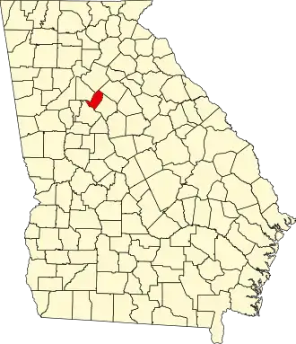
Rockdale County is een county in de Amerikaanse staat Georgia.
De county heeft een landoppervlakte van 338 km² en telt 70.111 inwoners (volkstelling 2000). De hoofdplaats is Conyers.
In de county ligt het Panola Mountain State Park met de berg Panola Mountain.
Bevolkingsontwikkeling
| Jaar | Inwoners | % ± | |
|---|---|---|---|
| 1900 | 7.515 | — | |
| 1910 | 8.916 | 18,6% | |
| 1920 | 9.521 | 6,8% | |
| 1930 | 7.247 | −23,9% | |
| 1940 | 7.724 | 6,6% | |
| 1950 | 8.464 | 9,6% | |
| 1960 | 10.572 | 24,9% | |
| 1970 | 18.152 | 71,7% | |
| 1980 | 36.747 | 102,4% | |
| 1990 | 54.091 | 47,2% | |
| 2000 | 70.111 | 29,6% | |
| Bron: (en) Historical Decennial Census Population | |||