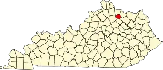
Robertson County (Kentucky)
| County in de Verenigde Staten | |||
|---|---|---|---|
| |||
| Situering | |||
| Staat | Kentucky | ||
| Coördinaten | 38°30'36"NB, 84°3'0"WL | ||
| Algemeen | |||
| Oppervlakte | 259 km² | ||
| - land | 259 km² | ||
| - water | 0 km² | ||
| Inwoners (2000) |
2.266 (9 inw./km²) | ||
| Overig | |||
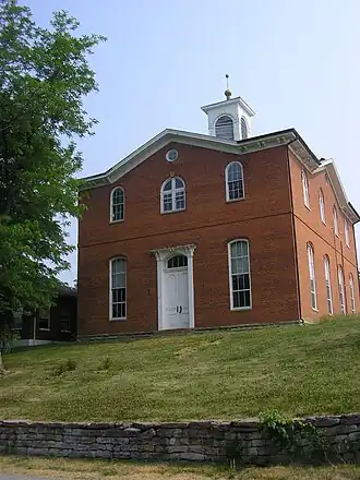
| Zetel | Mount Olivet | ||
| FIPS-code | 21201 | ||
| Opgericht | 1867 | ||
| Website | www | ||
| Foto's | |||
| |||
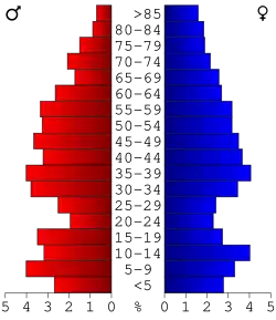 Bevolkingspiramide Robertson County | |||
| Statistieken volkstelling Robertson County | |||
| |||
Robertson County is een county in de Amerikaanse staat Kentucky.
De county heeft een landoppervlakte van 259 km² en telt 2.266 inwoners (volkstelling 2000). De hoofdplaats is Mount Olivet.
Bevolkingsontwikkeling
| Jaar | Inwoners | % ± | |
|---|---|---|---|
| 1900 | 4.900 | — | |
| 1910 | 4.121 | −15,9% | |
| 1920 | 3.871 | −6,1% | |
| 1930 | 3.344 | −13,6% | |
| 1940 | 3.419 | 2,2% | |
| 1950 | 2.881 | −15,7% | |
| 1960 | 2.443 | −15,2% | |
| 1970 | 2.163 | −11,5% | |
| 1980 | 2.265 | 4,7% | |
| 1990 | 2.124 | −6,2% | |
| 2000 | 2.266 | 6,7% | |
| Bron: (en) Historical Decennial Census Population | |||