Putnam County (Indiana)
| County in de Verenigde Staten | |||
|---|---|---|---|
| |||
| Situering | |||
| Staat | Indiana | ||
| Coördinaten | 39°40'12"NB, 86°50'24"WL | ||
| Algemeen | |||
| Oppervlakte | 1.250 km² | ||
| - land | 1.244 km² | ||
| - water | 6 km² | ||
| Inwoners (2000) |
36.019 (29 inw./km²) | ||
| Overig | |||
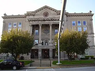
| Zetel | Greencastle | ||
| FIPS-code | 18133 | ||
| Opgericht | 1821 | ||
| Website | co | ||
| Foto's | |||
| |||
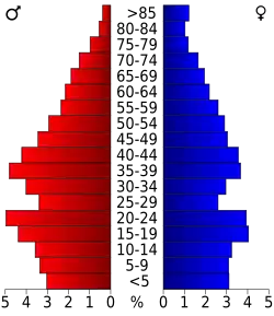 Bevolkingspiramide Putnam County | |||
| Statistieken volkstelling Putnam County | |||
| |||
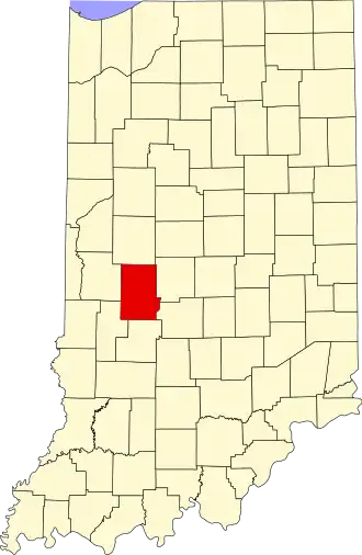
Putnam County is een county in de Amerikaanse staat Indiana.
De county heeft een landoppervlakte van 1.244 km² en telt 36.019 inwoners (volkstelling 2000). De hoofdplaats is Greencastle.
Bevolkingsontwikkeling
| Jaar | Inwoners | % ± | |
|---|---|---|---|
| 1900 | 21.478 | — | |
| 1910 | 20.520 | −4,5% | |
| 1920 | 19.880 | −3,1% | |
| 1930 | 20.448 | 2,9% | |
| 1940 | 20.839 | 1,9% | |
| 1950 | 22.950 | 10,1% | |
| 1960 | 24.927 | 8,6% | |
| 1970 | 26.932 | 8,0% | |
| 1980 | 29.163 | 8,3% | |
| 1990 | 30.315 | 4,0% | |
| 2000 | 36.019 | 18,8% | |
| Bron: (en) Historical Decennial Census Population | |||