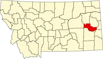
Prairie County (Montana)
| County in de Verenigde Staten | |||
|---|---|---|---|
| |||
| Situering | |||
| Staat | Montana | ||
| Coördinaten | 46°51'0"NB, 105°22'12"WL | ||
| Algemeen | |||
| Oppervlakte | 4.514 km² | ||
| - land | 4.498 km² | ||
| - water | 16 km² | ||
| Inwoners (2000) |
1.199 (0 inw./km²) | ||
| Overig | |||
| Zetel | Terry | ||
| FIPS-code | 30079 | ||
| Opgericht | 1915 | ||
| Website | www | ||
| Foto's | |||

| |||
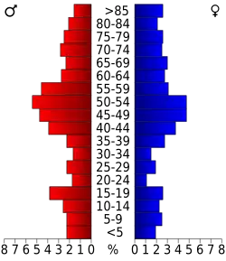 Bevolkingspiramide Prairie County | |||
| Statistieken volkstelling Prairie County | |||
| |||
Prairie County is een county in de Amerikaanse staat Montana.
De county heeft een landoppervlakte van 4.498 km² en telt 1.199 inwoners (volkstelling 2000). De hoofdplaats is Terry.