Powell County (Kentucky)
| County in de Verenigde Staten | |||
|---|---|---|---|
| |||
| Situering | |||
| Staat | Kentucky | ||
| Coördinaten | 37°49'48"NB, 83°49'48"WL | ||
| Algemeen | |||
| Oppervlakte | 467 km² | ||
| - land | 467 km² | ||
| - water | 0 km² | ||
| Inwoners (2000) |
13.237 (28 inw./km²) | ||
| Overig | |||
| Zetel | Stanton | ||
| FIPS-code | 21197 | ||
| Opgericht | 1852 | ||
| Website | www | ||
| Foto's | |||

| |||
 Bevolkingspiramide Powell County | |||
| Statistieken volkstelling Powell County | |||
| |||
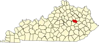
Powell County is een county in de Amerikaanse staat Kentucky.
De county heeft een landoppervlakte van 467 km² en telt 13.237 inwoners (volkstelling 2000). De hoofdplaats is Stanton.
Bevolkingsontwikkeling
| Jaar | Inwoners | % ± | |
|---|---|---|---|
| 1900 | 6.443 | — | |
| 1910 | 6.268 | −2,7% | |
| 1920 | 6.745 | 7,6% | |
| 1930 | 5.800 | −14,0% | |
| 1940 | 7.671 | 32,3% | |
| 1950 | 6.812 | −11,2% | |
| 1960 | 6.674 | −2,0% | |
| 1970 | 7.704 | 15,4% | |
| 1980 | 11.101 | 44,1% | |
| 1990 | 11.686 | 5,3% | |
| 2000 | 13.237 | 13,3% | |
| Bron: (en) Historical Decennial Census Population | |||