Pottawatomie County (Kansas)
| County in de Verenigde Staten | |||
|---|---|---|---|
| |||
| Situering | |||
| Staat | Kansas | ||
| Coördinaten | 39°19'59,9"NB, 96°18'0,0"WL | ||
| Algemeen | |||
| Oppervlakte | 2.233 km² | ||
| - land | 2.187 km² | ||
| - water | 46 km² | ||
| Inwoners (2000) |
18.209 (8 inw./km²) | ||
| Overig | |||
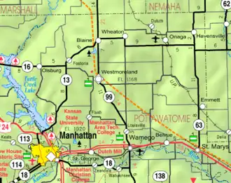
| Zetel | Westmoreland | ||
| FIPS-code | 20149 | ||
| Opgericht | 1857 | ||
| Website | www | ||
| Detailkaart | |||
| |||
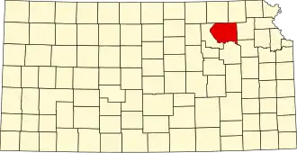
| Overzichtskaart van Pottawatomie County | |||
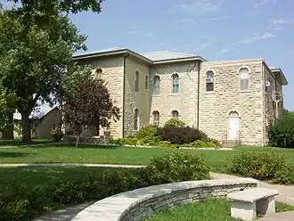
| Foto's | |||
| |||
 Bevolkingspiramide Pottawatomie County | |||
| Statistieken volkstelling Pottawatomie County | |||
| |||
Pottawatomie County is een county in de Amerikaanse staat Kansas.
De county heeft een landoppervlakte van 2.187 km² en telt 18.209 inwoners (volkstelling 2000). De hoofdplaats is Westmoreland.
Bevolkingsontwikkeling
| Jaar | Inwoners | % ± | |
|---|---|---|---|
| 1900 | 18.470 | — | |
| 1910 | 17.522 | −5,1% | |
| 1920 | 16.154 | −7,8% | |
| 1930 | 15.862 | −1,8% | |
| 1940 | 14.015 | −11,6% | |
| 1950 | 12.344 | −11,9% | |
| 1960 | 11.957 | −3,1% | |
| 1970 | 11.755 | −1,7% | |
| 1980 | 14.782 | 25,8% | |
| 1990 | 16.128 | 9,1% | |
| 2000 | 18.209 | 12,9% | |
| Bron: (en) Historical Decennial Census Population | |||