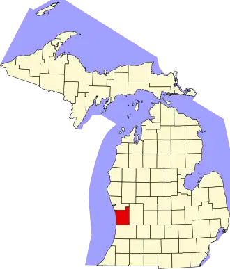
Ottawa County (Michigan)
| County in de Verenigde Staten | |||
|---|---|---|---|
| |||
| Situering | |||
| Staat | Michigan | ||
| Coördinaten | 42°55'12"NB, 86°13'48"WL | ||
| Algemeen | |||
| Oppervlakte | 4.227 km² | ||
| - land | 1.465 km² | ||
| - water | 2.762 km² | ||
| Inwoners (2000) |
238.314 (163 inw./km²) | ||
| Overig | |||
| Zetel | Grand Haven | ||
| FIPS-code | 26139 | ||
| Opgericht | 1831 | ||
| Website | www | ||
| Foto's | |||
_-_Holland%252C_Michigan.jpg)
| |||
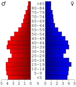 Bevolkingspiramide Ottawa County | |||
| Statistieken volkstelling Ottawa County | |||
| |||
Ottawa County is een county in de Amerikaanse staat Michigan.
De county heeft een landoppervlakte van 1.465 km² en telt 238.314 inwoners (volkstelling 2000). De hoofdplaats is Grand Haven.
Bevolkingsontwikkeling
| Jaar | Inwoners | % ± | |
|---|---|---|---|
| 1900 | 39.667 | — | |
| 1910 | 45.301 | 14,2% | |
| 1920 | 47.660 | 5,2% | |
| 1930 | 54.858 | 15,1% | |
| 1940 | 59.660 | 8,8% | |
| 1950 | 73.751 | 23,6% | |
| 1960 | 98.719 | 33,9% | |
| 1970 | 128.181 | 29,8% | |
| 1980 | 157.174 | 22,6% | |
| 1990 | 187.768 | 19,5% | |
| 2000 | 238.314 | 26,9% | |
| Bron: (en) Historical Decennial Census Population | |||
Politiek
Ottawa County, deel van een regionale Biblebelt, is de meest republikeinse county van Michigan en een van de meest republikeinse van het land. Sinds 1864 heeft bij alle presidentsverkiezingen een republikein in Ottawa County de meeste stemmen behaald.