Otsego County (Michigan)
| County in de Verenigde Staten | |||
|---|---|---|---|
| |||
| Situering | |||
| Staat | Michigan | ||
| Coördinaten | 45°1'12"NB, 84°36'36"WL | ||
| Algemeen | |||
| Oppervlakte | 1.363 km² | ||
| - land | 1.333 km² | ||
| - water | 30 km² | ||
| Inwoners (2000) |
23.301 (17 inw./km²) | ||
| Overig | |||
| Zetel | Gaylord | ||
| FIPS-code | 26137 | ||
| Opgericht | 1840 | ||
| Website | www | ||
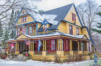
| Foto's | |||
| |||
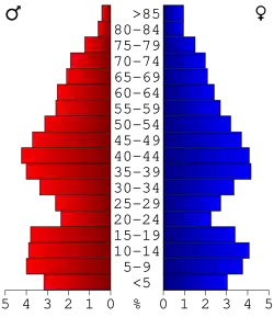 Bevolkingspiramide Otsego County | |||
| Statistieken volkstelling Otsego County | |||
| |||
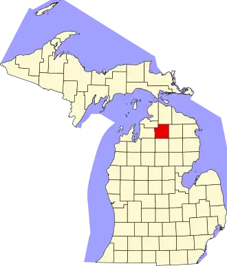
Otsego County is een county in de Amerikaanse staat Michigan.
De county heeft een landoppervlakte van 1.333 km² en telt 23.301 inwoners (volkstelling 2000). De hoofdplaats is Gaylord.
Bevolkingsontwikkeling
| Jaar | Inwoners | % ± | |
|---|---|---|---|
| 1900 | 6.175 | — | |
| 1910 | 6.552 | 6,1% | |
| 1920 | 6.043 | −7,8% | |
| 1930 | 5.554 | −8,1% | |
| 1940 | 5.827 | 4,9% | |
| 1950 | 6.435 | 10,4% | |
| 1960 | 7.545 | 17,2% | |
| 1970 | 10.422 | 38,1% | |
| 1980 | 14.993 | 43,9% | |
| 1990 | 17.957 | 19,8% | |
| 2000 | 23.301 | 29,8% | |
| Bron: (en) Historical Decennial Census Population | |||