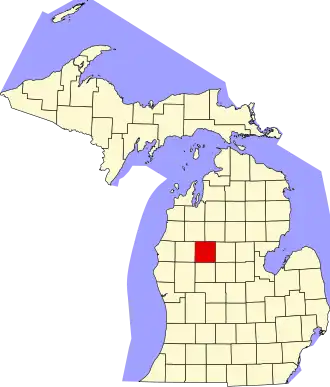
Osceola County (Michigan)
| County in de Verenigde Staten | |||
|---|---|---|---|
| |||
| Situering | |||
| Staat | Michigan | ||
| Coördinaten | 43°58'48"NB, 85°19'48"WL | ||
| Algemeen | |||
| Oppervlakte | 1.484 km² | ||
| - land | 1.466 km² | ||
| - water | 18 km² | ||
| Inwoners (2000) |
23.197 (16 inw./km²) | ||
| Overig | |||
| Zetel | Reed City | ||
| FIPS-code | 26133 | ||
| Opgericht | 1840 | ||
| Website | www | ||
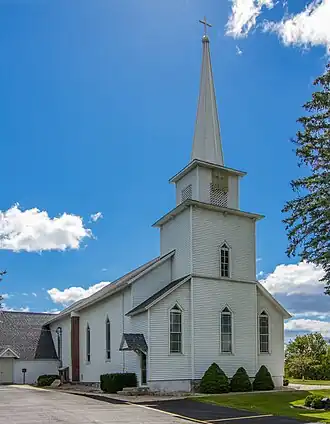
| Foto's | |||
| |||
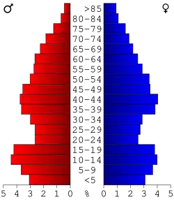 Bevolkingspiramide Osceola County | |||
| Statistieken volkstelling Osceola County | |||
| |||
Osceola County is een county in de Amerikaanse staat Michigan.
De county heeft een landoppervlakte van 1.466 km² en telt 23.197 inwoners (volkstelling 2000). De hoofdplaats is Reed City.
Bevolkingsontwikkeling
| Jaar | Inwoners | % ± | |
|---|---|---|---|
| 1900 | 17.859 | — | |
| 1910 | 17.889 | 0,2% | |
| 1920 | 15.221 | −14,9% | |
| 1930 | 12.806 | −15,9% | |
| 1940 | 13.309 | 3,9% | |
| 1950 | 13.797 | 3,7% | |
| 1960 | 13.595 | −1,5% | |
| 1970 | 14.838 | 9,1% | |
| 1980 | 18.928 | 27,6% | |
| 1990 | 20.146 | 6,4% | |
| 2000 | 23.197 | 15,1% | |
| Bron: (en) Historical Decennial Census Population | |||