Orange County (Indiana)
| County in de Verenigde Staten | |||
|---|---|---|---|
| |||
| Situering | |||
| Staat | Indiana | ||
| Coördinaten | 38°32'24"NB, 86°30'0"WL | ||
| Algemeen | |||
| Oppervlakte | 1.057 km² | ||
| - land | 1.035 km² | ||
| - water | 22 km² | ||
| Inwoners (2000) |
19.306 (19 inw./km²) | ||
| Overig | |||
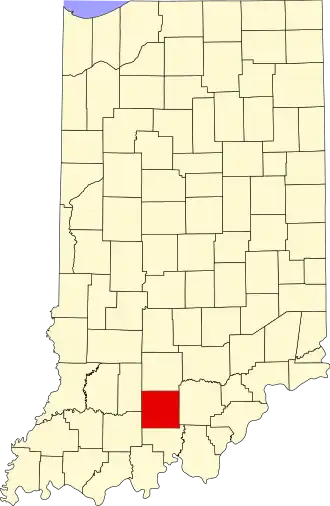
| Zetel | Paoli | ||
| FIPS-code | 18117 | ||
| Opgericht | 1815 | ||
| Website | www | ||
| Detailkaart | |||

| |||
| Orange County, Indiana | |||
| Foto's | |||

| |||
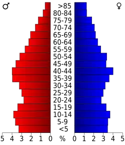 Bevolkingspiramide Orange County | |||
| Statistieken volkstelling Orange County | |||
| |||
Orange County is een county in de Amerikaanse staat Indiana.
De county heeft een landoppervlakte van 1.035 km² en telt 19.306 inwoners (volkstelling 2000). De hoofdplaats is Paoli.
Bevolkingsontwikkeling
| Jaar | Inwoners | % ± | |
|---|---|---|---|
| 1900 | 16.854 | — | |
| 1910 | 17.192 | 2,0% | |
| 1920 | 16.974 | −1,3% | |
| 1930 | 17.459 | 2,9% | |
| 1940 | 17.311 | −0,8% | |
| 1950 | 16.879 | −2,5% | |
| 1960 | 16.877 | −0,0% | |
| 1970 | 16.968 | 0,5% | |
| 1980 | 18.677 | 10,1% | |
| 1990 | 18.409 | −1,4% | |
| 2000 | 19.306 | 4,9% | |
| Bron: (en) Historical Decennial Census Population | |||
