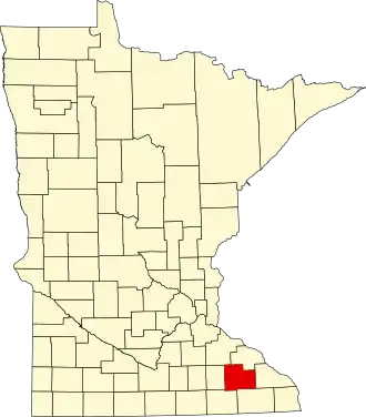
Olmsted County
| County in de Verenigde Staten | |||
|---|---|---|---|
| |||
| Situering | |||
| Staat | Minnesota | ||
| Coördinaten | 44°0'NB, 92°24'WL | ||
| Algemeen | |||
| Oppervlakte | 1.695 km² | ||
| - land | 1.691 km² | ||
| - water | 4 km² | ||
| Inwoners (2000) |
124.277 (73 inw./km²) | ||
| Overig | |||
| Zetel | Rochester | ||
| FIPS-code | 27109 | ||
| Opgericht | 1855 | ||
| Website | www | ||
| Foto's | |||

| |||
 Bevolkingspiramide Olmsted County | |||
| Statistieken volkstelling Olmsted County | |||
| |||
Olmsted County is een county in de Amerikaanse staat Minnesota.
De county heeft een landoppervlakte van 1.691 km² en telt 124.277 inwoners (volkstelling 2000). De hoofdplaats is Rochester.
Bevolkingsontwikkeling
| Jaar | Inwoners | % ± | |
|---|---|---|---|
| 1900 | 23.119 | — | |
| 1910 | 22.497 | −2,7% | |
| 1920 | 28.014 | 24,5% | |
| 1930 | 35.426 | 26,5% | |
| 1940 | 42.658 | 20,4% | |
| 1950 | 48.228 | 13,1% | |
| 1960 | 65.532 | 35,9% | |
| 1970 | 84.104 | 28,3% | |
| 1980 | 92.006 | 9,4% | |
| 1990 | 106.470 | 15,7% | |
| 2000 | 124.277 | 16,7% | |
| Bron: (en) Historical Decennial Census Population | |||