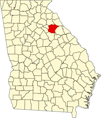
Oglethorpe County
| County in de Verenigde Staten | |||
|---|---|---|---|
| |||
| Situering | |||
| Staat | Georgia | ||
| Coördinaten | 33°52'48"NB, 83°4'48"WL | ||
| Algemeen | |||
| Oppervlakte | 1.145 km² | ||
| - land | 1.142 km² | ||
| - water | 3 km² | ||
| Inwoners (2000) |
12.635 (11 inw./km²) | ||
| Overig | |||
| Zetel | Lexington | ||
| FIPS-code | 13221 | ||
| Opgericht | 1793 | ||
| Website | onlineoglethorpe | ||
| Foto's | |||

| |||
 Bevolkingspiramide Oglethorpe County | |||
| Statistieken volkstelling Oglethorpe County | |||
| |||
Oglethorpe County is een county in de Amerikaanse staat Georgia.
De county heeft een landoppervlakte van 1.142 km² en telt 12.635 inwoners (volkstelling 2000). De hoofdplaats is Lexington.
Bevolkingsontwikkeling
| Jaar | Inwoners | % ± | |
|---|---|---|---|
| 1900 | 17.881 | — | |
| 1910 | 18.680 | 4,5% | |
| 1920 | 20.287 | 8,6% | |
| 1930 | 12.927 | −36,3% | |
| 1940 | 12.430 | −3,8% | |
| 1950 | 9.958 | −19,9% | |
| 1960 | 7.926 | −20,4% | |
| 1970 | 7.598 | −4,1% | |
| 1980 | 8.929 | 17,5% | |
| 1990 | 9.763 | 9,3% | |
| 2000 | 12.635 | 29,4% | |
| Bron: (en) Historical Decennial Census Population | |||