Oconee County (Georgia)
| County in de Verenigde Staten | |||
|---|---|---|---|
| |||
| Situering | |||
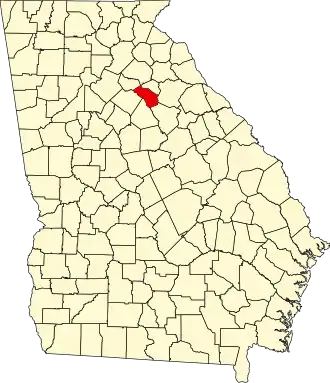
| Staat | Georgia | ||
| Coördinaten | 33°50'24"NB, 83°26'24"WL | ||
| Algemeen | |||
| Oppervlakte | 482 km² | ||
| - land | 481 km² | ||
| - water | 1 km² | ||
| Inwoners (2000) |
26.225 (55 inw./km²) | ||
| Overig | |||
| Zetel | Watkinsville | ||
| FIPS-code | 13219 | ||
| Opgericht | 1875 | ||
| Website | www | ||
| Foto's | |||

| |||
 Bevolkingspiramide Oconee County | |||
| Statistieken volkstelling Oconee County | |||
| |||
Oconee County is een county in de Amerikaanse staat Georgia.
De county heeft een landoppervlakte van 481 km² en telt 26.225 inwoners (volkstelling 2000). De hoofdplaats is Watkinsville.
Bevolkingsontwikkeling
| Jaar | Inwoners | % ± | |
|---|---|---|---|
| 1900 | 8.602 | — | |
| 1910 | 11.104 | 29,1% | |
| 1920 | 11.067 | −0,3% | |
| 1930 | 8.082 | −27,0% | |
| 1940 | 7.576 | −6,3% | |
| 1950 | 7.009 | −7,5% | |
| 1960 | 6.304 | −10,1% | |
| 1970 | 7.915 | 25,6% | |
| 1980 | 12.427 | 57,0% | |
| 1990 | 17.618 | 41,8% | |
| 2000 | 26.225 | 48,9% | |
| Bron: (en) Historical Decennial Census Population | |||