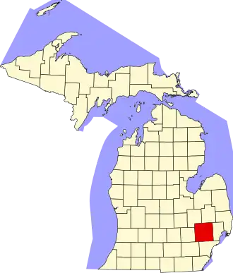
Oakland County
| County in de Verenigde Staten | |||
|---|---|---|---|
| |||
| Situering | |||
| Staat | Michigan | ||
| Coördinaten | 42°39'36"NB, 83°22'48"WL | ||
| Algemeen | |||
| Oppervlakte | 2.352 km² | ||
| - land | 2.260 km² | ||
| - water | 92 km² | ||
| Inwoners (2000) |
1.194.156 (528 inw./km²) | ||
| Overig | |||
| Zetel | Pontiac | ||
| FIPS-code | 26125 | ||
| Opgericht | 1820 | ||
| Website | www | ||
| Foto's | |||
.jpg)
| |||
 Bevolkingspiramide Oakland County | |||
| Statistieken volkstelling Oakland County | |||
| |||
Oakland County is een county in de Amerikaanse staat Michigan.
De county heeft een landoppervlakte van 2.260 km² en telt 1.194.156 inwoners (volkstelling 2000). De hoofdplaats is Pontiac.
Bevolkingsontwikkeling
| Jaar | Inwoners | % ± | |
|---|---|---|---|
| 1900 | 44.792 | — | |
| 1910 | 49.576 | 10,7% | |
| 1920 | 90.050 | 81,6% | |
| 1930 | 211.251 | 134,6% | |
| 1940 | 254.068 | 20,3% | |
| 1950 | 396.001 | 55,9% | |
| 1960 | 690.259 | 74,3% | |
| 1970 | 907.871 | 31,5% | |
| 1980 | 1.011.793 | 11,4% | |
| 1990 | 1.083.592 | 7,1% | |
| 2000 | 1.194.156 | 10,2% | |
| Bron: (en) Historical Decennial Census Population | |||