Noble County (Indiana)
| County in de Verenigde Staten | |||
|---|---|---|---|
| |||
| Situering | |||
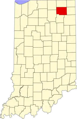
| Staat | Indiana | ||
| Coördinaten | 41°24'0"NB, 85°25'12"WL | ||
| Algemeen | |||
| Oppervlakte | 1.082 km² | ||
| - land | 1.065 km² | ||
| - water | 17 km² | ||
| Inwoners (2000) |
46.275 (43 inw./km²) | ||
| Overig | |||
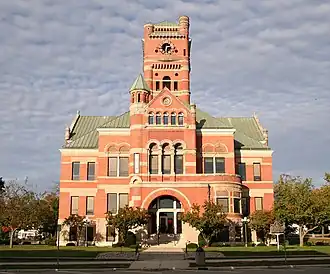
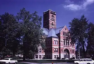
| Zetel | Albion | ||
| FIPS-code | 18113 | ||
| Opgericht | 1835 | ||
| Website | nobleco | ||
| Foto's | |||
| |||
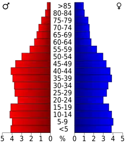 Bevolkingspiramide Noble County | |||
| Statistieken volkstelling Noble County | |||
| |||
Noble County is een county in de Amerikaanse staat Indiana.
De county heeft een landoppervlakte van 1.065 km² en telt 46.275 inwoners (volkstelling 2000). De hoofdplaats is Albion.
In Wayne County ligt het op een na hoogste punt van de staat Indiana: Sand Hill.
Bevolkingsontwikkeling
| Jaar | Inwoners | % ± | |
|---|---|---|---|
| 1900 | 23.533 | — | |
| 1910 | 24.009 | 2,0% | |
| 1920 | 22.470 | −6,4% | |
| 1930 | 22.404 | −0,3% | |
| 1940 | 22.776 | 1,7% | |
| 1950 | 25.075 | 10,1% | |
| 1960 | 28.162 | 12,3% | |
| 1970 | 31.382 | 11,4% | |
| 1980 | 35.443 | 12,9% | |
| 1990 | 37.877 | 6,9% | |
| 2000 | 46.275 | 22,2% | |
| Bron: (en) Historical Decennial Census Population | |||