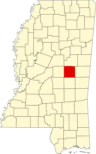
Neshoba County
| County in de Verenigde Staten | |||
|---|---|---|---|
| |||
| Situering | |||
| Staat | Mississippi | ||
| Coördinaten | 32°45'0"NB, 89°7'12"WL | ||
| Algemeen | |||
| Oppervlakte | 1.480 km² | ||
| - land | 1.476 km² | ||
| - water | 4 km² | ||
| Inwoners (2000) |
28.684 (19 inw./km²) | ||
| Overig | |||
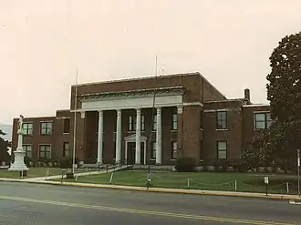
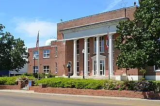
| Zetel | Philadelphia | ||
| FIPS-code | 28099 | ||
| Opgericht | 1833 | ||
| Website | www | ||
| Foto's | |||
| |||
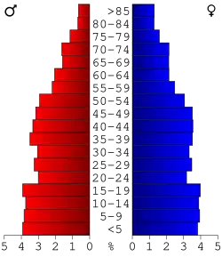 Bevolkingspiramide Neshoba County | |||
| Statistieken volkstelling Neshoba County | |||
| |||
Neshoba County is een county in de Amerikaanse staat Mississippi.
De county heeft een landoppervlakte van 1.476 km² en telt 28.684 inwoners (volkstelling 2000). De hoofdplaats is Philadelphia.
Bevolkingsontwikkeling
| Jaar | Inwoners | % ± | |
|---|---|---|---|
| 1900 | 12.726 | — | |
| 1910 | 17.980 | 41,3% | |
| 1920 | 19.303 | 7,4% | |
| 1930 | 26.691 | 38,3% | |
| 1940 | 27.882 | 4,5% | |
| 1950 | 25.730 | −7,7% | |
| 1960 | 20.927 | −18,7% | |
| 1970 | 20.802 | −0,6% | |
| 1980 | 23.789 | 14,4% | |
| 1990 | 24.800 | 4,2% | |
| 2000 | 28.684 | 15,7% | |
| Bron: (en) Historical Decennial Census Population | |||