Neosho County
| County in de Verenigde Staten | |||
|---|---|---|---|
| |||
| Situering | |||
| Staat | Kansas | ||
| Coördinaten | 37°40'57"NB, 95°17'51"WL | ||
| Algemeen | |||
| Oppervlakte | 1.497 km² | ||
| - land | 1.481 km² | ||
| - water | 16 km² | ||
| Inwoners (2000) |
16.997 (11 inw./km²) | ||
| Overig | |||
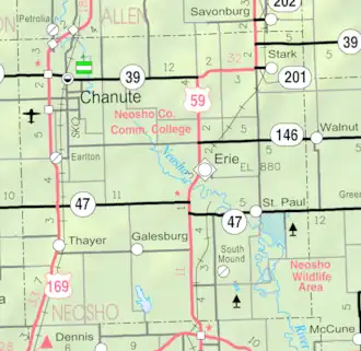
| Zetel | Erie | ||
| FIPS-code | 20133 | ||
| Opgericht | 1861 | ||
| Website | www | ||
| Detailkaart | |||
| |||
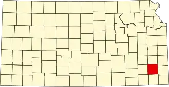
| Overzichtskaart van Neosho County | |||
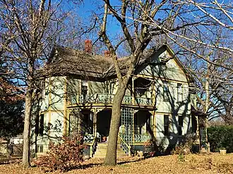
| Foto's | |||
| |||
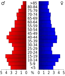 Bevolkingspiramide Neosho County | |||
| Statistieken volkstelling Neosho County | |||
| |||
Neosho County is een county in de Amerikaanse staat Kansas, vernoemd naar de Neosho-rivier.
De county heeft een landoppervlakte van 1.481 km² en telt 16.997 inwoners (volkstelling 2000). De hoofdplaats is Erie.
Bevolkingsontwikkeling
| Jaar | Inwoners | % ± | |
|---|---|---|---|
| 1900 | 19.254 | — | |
| 1910 | 23.754 | 23,4% | |
| 1920 | 24.000 | 1,0% | |
| 1930 | 22.665 | −5,6% | |
| 1940 | 22.210 | −2,0% | |
| 1950 | 20.348 | −8,4% | |
| 1960 | 19.455 | −4,4% | |
| 1970 | 18.812 | −3,3% | |
| 1980 | 18.967 | 0,8% | |
| 1990 | 17.035 | −10,2% | |
| 2000 | 16.997 | −0,2% | |
| Bron: (en) Historical Decennial Census Population | |||
Zie de categorie Neosho County, Kansas van Wikimedia Commons voor mediabestanden over dit onderwerp.