Nemaha County (Kansas)
| County in de Verenigde Staten | |||
|---|---|---|---|
| |||
| Situering | |||
| Staat | Kansas | ||
| Coördinaten | 39°48'NB, 96°0'WL | ||
| Algemeen | |||
| Oppervlakte | 1.864 km² | ||
| - land | 1.860 km² | ||
| - water | 4 km² | ||
| Inwoners (2000) |
10.717 (6 inw./km²) | ||
| Overig | |||
| Zetel | Seneca | ||
| FIPS-code | 20131 | ||
| Opgericht | 1855 | ||
| Website | www | ||
| Detailkaart | |||

| |||
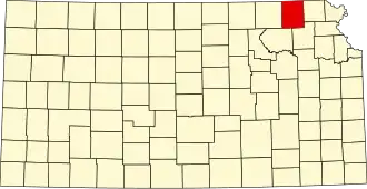
| Overzichtskaart van Nemaha County | |||
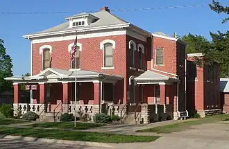
| Foto's | |||
| |||
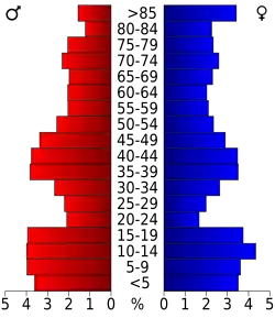 Bevolkingspiramide Nemaha County | |||
| Statistieken volkstelling Nemaha County | |||
| |||
Nemaha County is een county in de Amerikaanse staat Kansas.
De county heeft een landoppervlakte van 1.860 km² en telt 10.717 inwoners (volkstelling 2000). De hoofdplaats is Seneca.
Bevolkingsontwikkeling
| Jaar | Inwoners | % ± | |
|---|---|---|---|
| 1900 | 20.376 | — | |
| 1910 | 19.072 | −6,4% | |
| 1920 | 18.487 | −3,1% | |
| 1930 | 18.342 | −0,8% | |
| 1940 | 16.761 | −8,6% | |
| 1950 | 14.341 | −14,4% | |
| 1960 | 12.897 | −10,1% | |
| 1970 | 11.825 | −8,3% | |
| 1980 | 11.211 | −5,2% | |
| 1990 | 10.446 | −6,8% | |
| 2000 | 10.717 | 2,6% | |
| Bron: (en) Historical Decennial Census Population | |||