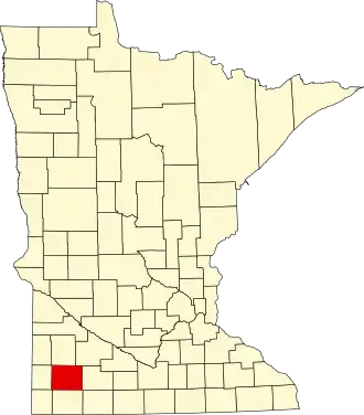
Murray County (Minnesota)
| County in de Verenigde Staten | |||
|---|---|---|---|
| |||
| Situering | |||
| Staat | Minnesota | ||
| Coördinaten | 44°1'12"NB, 95°45'36"WL | ||
| Algemeen | |||
| Oppervlakte | 1.863 km² | ||
| - land | 1.824 km² | ||
| - water | 39 km² | ||
| Inwoners (2000) |
9.165 (5 inw./km²) | ||
| Overig | |||
| Zetel | Slayton | ||
| FIPS-code | 27101 | ||
| Opgericht | 1857 | ||
| Website | www | ||
| Foto's | |||

| |||
 Bevolkingspiramide Murray County | |||
| Statistieken volkstelling Murray County | |||
| |||
Murray County is een county in de Amerikaanse staat Minnesota.
De county heeft een landoppervlakte van 1.824 km² en telt 9.165 inwoners (volkstelling 2000). De hoofdplaats is Slayton.
Bevolkingsontwikkeling
| Jaar | Inwoners | % ± | |
|---|---|---|---|
| 1900 | 11.911 | — | |
| 1910 | 11.755 | −1,3% | |
| 1920 | 13.631 | 16,0% | |
| 1930 | 13.902 | 2,0% | |
| 1940 | 15.060 | 8,3% | |
| 1950 | 14.801 | −1,7% | |
| 1960 | 14.743 | −0,4% | |
| 1970 | 12.508 | −15,2% | |
| 1980 | 11.507 | −8,0% | |
| 1990 | 9.660 | −16,1% | |
| 2000 | 9.165 | −5,1% | |
| Bron: (en) Historical Decennial Census Population | |||