Muntinlupa
| Stad in de Filipijnen | |||
|---|---|---|---|
 | |||
| Situering | |||
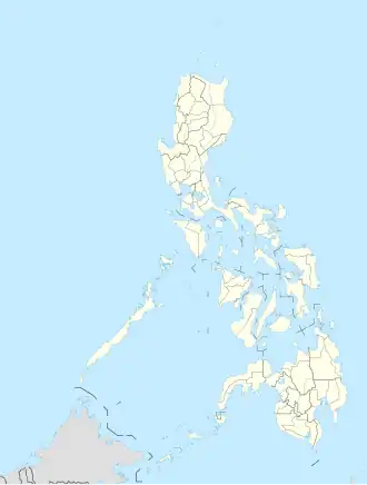
| Eiland | Luzon | ||
| Regio | National Capital Region (NCR) | ||
| Coördinaten | 14° 22′ NB, 121° 2′ OL | ||
| Statistische informatie | |||
| Oppervlakte | 39,8[1] km² | ||
| Inwoners (2020) |
543.445 (13.874 inw./km²) | ||
| Bestuurlijke informatie | |||
| Barangays | 9 | ||
| Overige informatie | |||
| Tijdzone | UTC+8 | ||
| Website | muntinlupacity.gov.ph/ | ||
| Detailkaart | |||
| |||
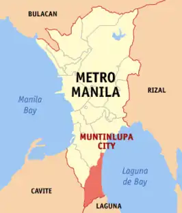
| Positie van Muntinlupa binnen National Capital Region (NCR) | |||
| Foto's | |||

| |||
|
| |||
| De skyline van Muntinlupa | |||
| |||
Muntinlupa is een stad op het eiland Luzon in de Filipijnen. Ze vormt samen met 16 andere steden en gemeenten de National Capital Region, die ook wel Metro Manilla wordt genoemd. Bij de volkstelling van 2020 had de stad 543.445 inwoners.[2]
Geografie
Bestuurlijke indeling
Muntinlupa is onderverdeeld in de volgende 9 barangays[3]:
- Alabang
- Bayanan
- Buli
- Cupang
- Poblacion
- Putatan
- Sucat
- Tunasan
- New Alabang Village
Bronnen
- ↑ Oppervlaktecijfers uit 2007, National Statistical Coordination Board (NSCB).
- ↑ Luzon (Philippines): Regions & Major Places - Population Statistics, Maps, Charts, Weather and Web Information. www.citypopulation.de. Geraadpleegd op 5 mei 2025.
- ↑ Philippine Standard Geographic Code